


Trainsity Manila LRT MRT PNR
Beschreibung von Trainsity Manila LRT MRT PNR
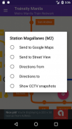
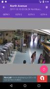
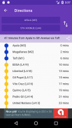
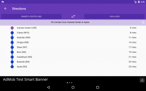
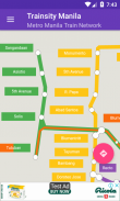
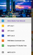
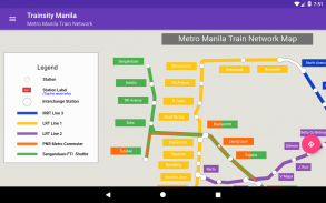
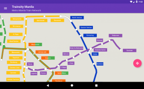
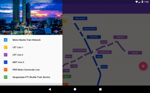
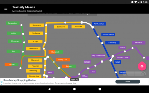
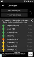
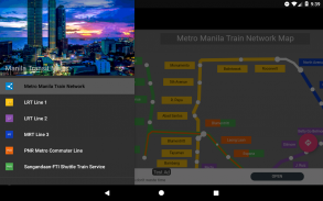
Navigieren Sie mühelos durch Manila und andere öffentliche Bahnnetze weltweit mit den hochauflösenden Vektorkarten unserer App. Wählen und laden Sie die benötigten Karten herunter und profitieren Sie von detaillierten Zoomstufen, ohne Speicherplatz zu verbrauchen. Sehen Sie sich Fahrpläne und Frequenzen der Züge sowie die ersten und letzten Abfahrten der Bahnhöfe an (für Karten mit Fahrplänen). Greifen Sie offline auf alle Funktionen zu, ohne Internetverbindung.
Entdecken Sie Bahnnetze ganz einfach mit unserer intuitiven und effizienten App.
Karten aktuell verfügbar für:
– Singapur
– Kuala Lumpur, Malaysia
– Sapporo, Japan
– Recife, Brasilien
– Brasilia, Brasilien
– Vancouver, Kanada
– Hongkong, China
– Bangkok, Thailand
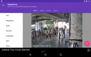
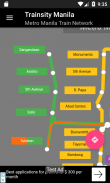
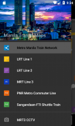
– Manila, Philippinen
– Osaka, Japan
– Amsterdam, Niederlande
– Hanoi, Vietnam
– Utrecht, Niederlande
– Jakarta, Indonesien
– Rio de Janeiro, Brasilien
– Palembang, Indonesien
– Edmonton, Kanada
– Calgary, Kanada
– Sydney, Australien
– Fukuoka, Japan
– Paris, Frankreich
– Fortaleza, Brasilien
– Montreal, Kanada
– Rom, Italien
– Toronto, Kanada
– Lyon, Frankreich
– Algier, Algerien
– São Paulo, Brasilien
– Perth, Australien
– Ho-Chi-Minh-Stadt, Vietnam
– Mailand, Italien
– Nürnberg, Deutschland
– Kopenhagen, Dänemark
– Sobral, Brasilien
– Natal, Brasilien
Von der App unterstützte Sprachen:
Englisch, Malaiisch, Indonesisch Chinesisch, Portugiesisch, Japanisch, Tamil, Thai, Spanisch, Niederländisch, Vietnamesisch, Französisch, Italienisch, Arabisch, Deutsch, Dänisch
Trainsity Manila LRT MRT PNR – Version 2.10.0
(12-02-2025)Trainsity Manila LRT MRT PNR – APK Informationen
APK Version: 2.10.0Paket: com.dom925.trainsity.manilaNeueste Version von Trainsity Manila LRT MRT PNR
Weitere Versionen


Apps in derselben Kategorie


Das könnte dir auch gefallen...


